Home> Annapurna Region> Annapurna Circuit Trekking
Trip Code: MPAEAT-02
Duration: 23 days
Program Type: Trekking
Max. Altitude: 5416m
Minimum Pax: 2+
Mode of Travel: Land
Start Trip: Besi Sahar
End Trip: Birenthanti
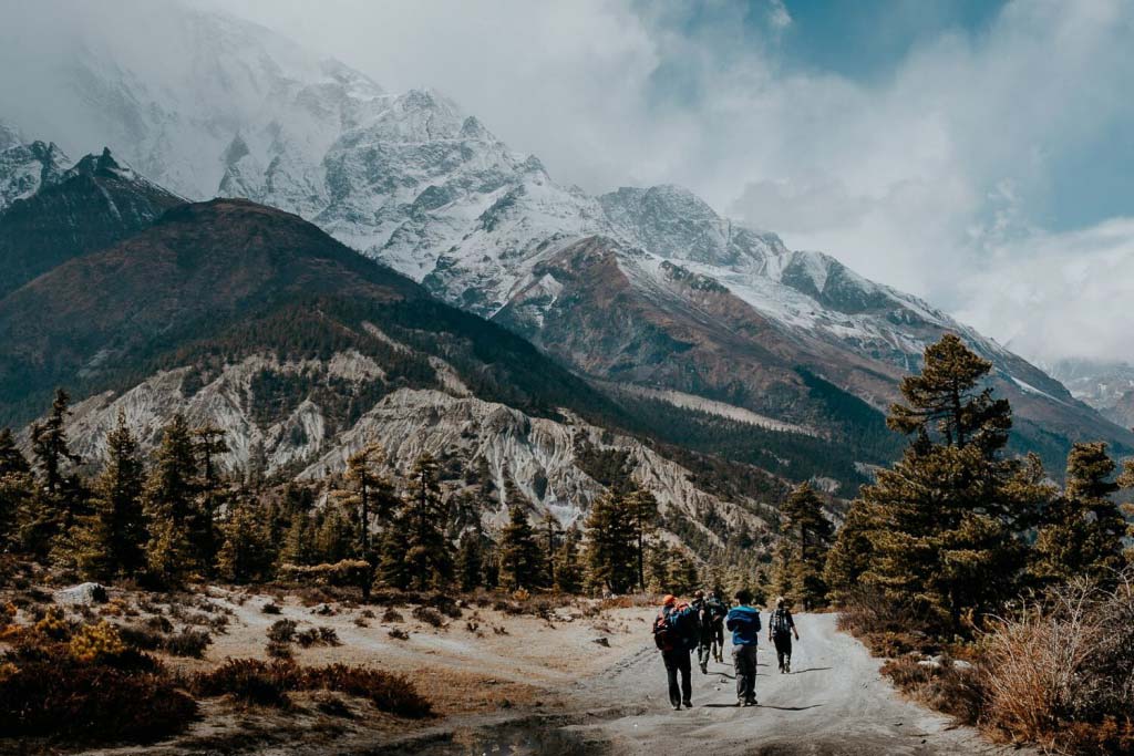
Annapurna Circuit Trekking is known as most popular and classical trek in the Annapurna region. This trekking trail is also recommended as one of the twenty best trekking trails all over the world. This trekking trail will take you to the villages with great mountain views, different castes people like Gurungs, Magars, Brahmins, Chhetris, Newars. You will start your trek from Besi Sahar. This trail (Ngadi) can also be seen in The National Geographic but the road has been destroyed by the landslide. Throughout this trekking trail you will share the way with small caravan who transport supplies to the remote village of this area. There will be small fields of millet and wheat, small flock of sheeps and goats. Thakalis and tribes controls the trading and pilgrimage trails. You will trek through different small villages like Khudi, Bhulbule, Ngadi, Lampata, Bahundanda, Jagat, Khorte, Dharapani etc.
Day 01: Arrivel in Kathmandu and meet our staff then transfer to hotel.
Day 02: Sightseeing in Kathmandu valley.
Day 03: Drive out from Kathmandu to Besisahar.
Early in the morning by reserved bus & local bus (depends on the size of the group).
Day 04: Besi Sahar to Bahundanda (hill of the Brahmins, 1,310 m.).
Along the route the trail follows a stream and climbs to Denauti, and then slippery rocks lead to the Marshyangdi Khola. During this route the villages Khudi. Ngadi and Lampa are interesting to see.
Day 05: Bahudanda to Chamje (2,160 m.)
Beautiful water falls, some forests full of birds, villages occupied by Tibetan heritage. Tea houses and guests houses are available.
Day 06: Chamje to Bagarchhap (2,160 m.).
It is a village of Tibetan architecture. A well mentioned Diki Gompa is a famous place to see.
Day 07: Bagarchhap to Chame (2,630 m.).
This is a nice camping place and several years ago it was the district Headquarters of Manang. Police check post, School, Health post, Post office, Bank, wireless station are there, with the facility of electricity. On the route the Annapurna (II 7,937 m.), (IV 7,525.), Ganesh Himal and Manasalu Himal (8,156 m.) are visible.
Day 08: Chame to Pisang (3,190 m.).
A Khampa settlement is known as Bratang now days abandoned. One can find over there a stone memory to a Japanese climber who died in an avalanche. Crossing the Thorong La pass, Pisang peak, Annapurna II and other natural beauties blow one's mind.
Day 09: Pisang to Manang (3,335 m. Approx.).
During the trek we cross the place, known as Nyseyang (wheat barley). They also grow potatoes and beans. Horses are the means of transportation. Life standard is better at Manang. There is a chance to buy medicines and warm clothes.
Day 10: Pisang to Manang a day to acclimatize.
There is a good opportunity to climb the north ridge of the village and have a view of the Annapurna II, IV, Glacier Dome and other excellent sceneries.
Day 11: Manang to Letdar.
Trail crosses a stream, climbs to Tingi and continues to Marsyangdi valley. Yak Kharka and Letdear is next to last shelter before the pass.
Day 12: Letdear to Thorang Phedi. A wooden bridge at (3,320 m.).
Hould be crossed to reach Thorang Phedi (4,420 m.). Sometime snow can block the pass. In such a situation this place is really crowded. Usually people schedule is 3 a.m. to departure, which is not necessary. The ideal departure could be made between 4 and 5 a.m.
Day 13: Thorang Phedi to Muktinath (3,800 m.).
During the season of December to January there are very few chances to cross Thorang La pass (5416m.). If porters are not well equipped, they may suffer badly due to the cold and expectable storm.
Day 14: Muktinath to Jomsom (2,713 m.).
Trail descends to Jomsom, this is a nice place from where trek could be shortened by flight back to Pokhara or Kathmandu.
Day 15: Jomsom to Kalopani (2,580 m.)
Trek becomes easier as trail follows downwards. But no doubt, natural beauties are unforgettable. You may enjoy along the route the view of Dhaulagiri, Nilgiri, and Annapurna I and so on.
Day 16: Kalopani to Tatopani (1,680 m.).
Tatopani means hot water in Nepali. Thus this village gains the name as Tatopani from the hot spring.
Day 17: Tatopani rest:
This is a spot with more facilities and there are hotels and guesthouses which offers good accommodation.
Day 18: Tatopani to Ghorepani (2,775 m.).
Ghorepani means horse water in Nepal. Along the route you will have a panoramic view of Dhaulagiri, Tukuche peak, Annapurna south, Annapurna I, Nilgiri, Himalchuli and the Glacier. They all are excellent to be explored.
Day 19: Ghorepani to Ghandruk.
Beautiful tourist place and village of Gurung people culture.
Day 20: 3 hrs trek from Ghandruk to Birethanti.
From Birethanti 3 hrs drive to Pokhara. Overnight at Pokahra.
Day 21: Drive/flgiht back from Pokhara to Kathmandu.
Day 22: Free day/Shoping day in Kathmandu.
Day 23: Final depature day/ Back to homeland.